by Dann Cianca
2008 Storm Chase VII - August 13th - "Alta Vista Tornado"
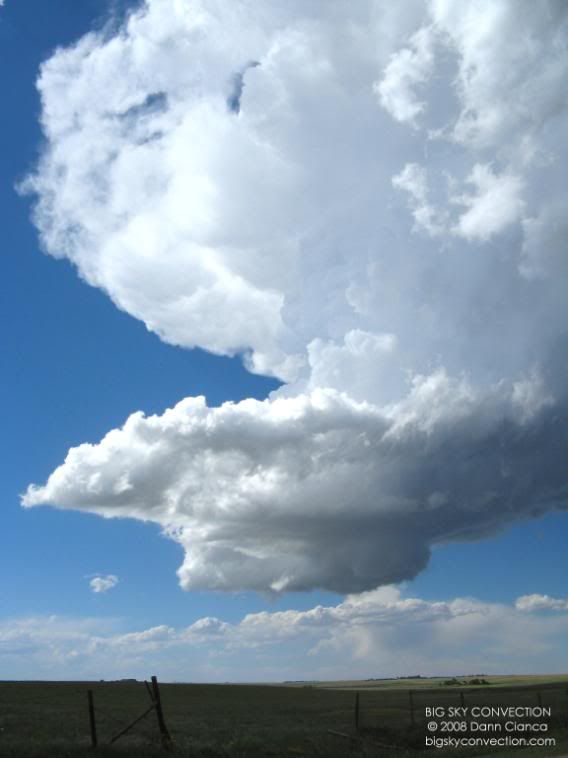
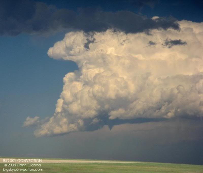
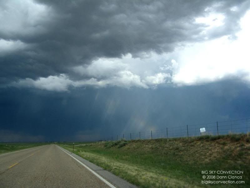
Convection had already initiated along the Palmer Divide and on a convergence boundary that stretched southwest to northeast. By the time we passed Deer Trail, our attention turned from the cumulus to the east to a cell popping up just northwest of Limon.
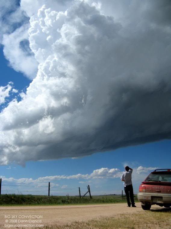
As we approached it, the storm began to look stronger. The updraft base was very robust and it began to tower. I envisioned paralleling it southward out of Limon on CO 71, but Michael thought it would be better to get closer and track it on dirt, which was the right choice. We left I-70 at Cedar Point and stopped on a hillside to survey the scene.
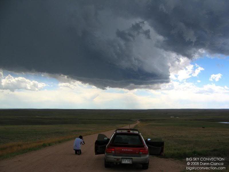
Crossing Colorado 86 and then
southbound on Elbert County 149.
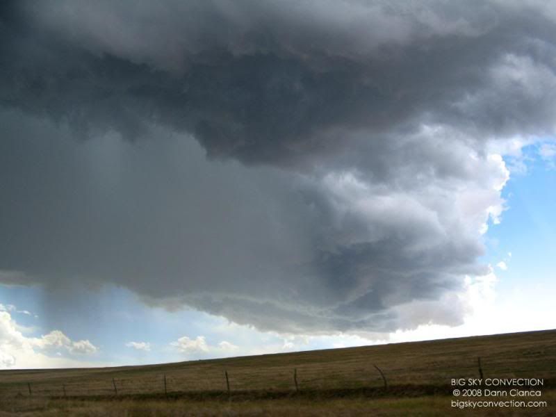
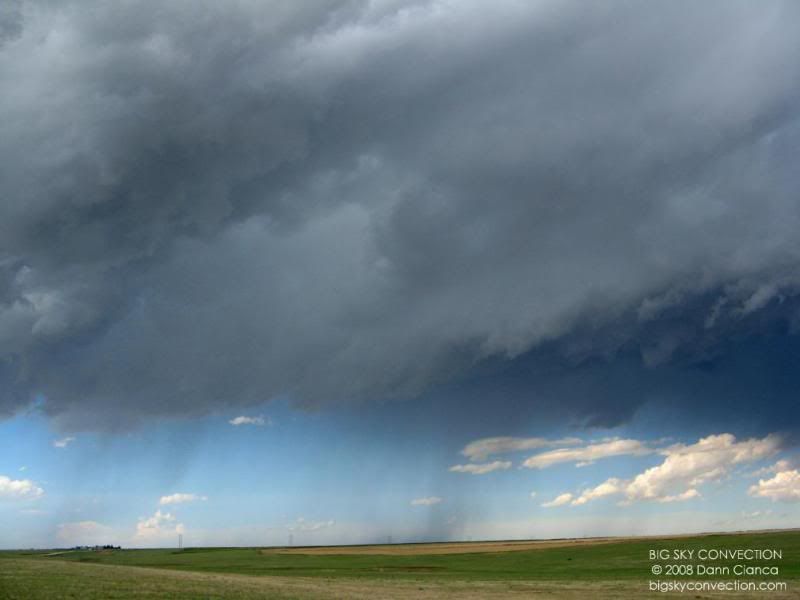
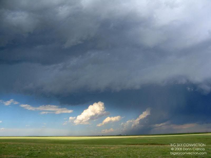
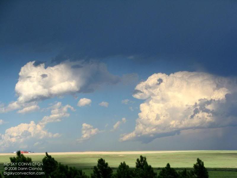
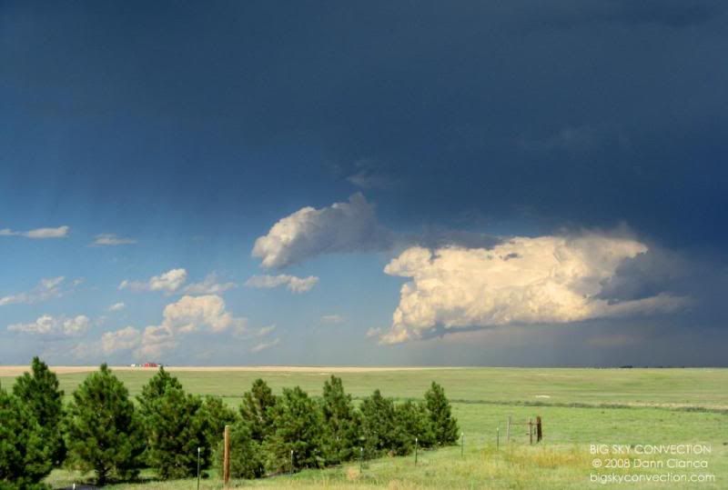
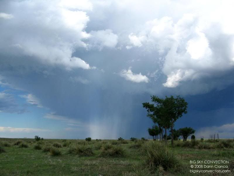
By this point, we had
come through the main downdraft of the storm, only experiencing some moderate
rain. The photo below was taken just before we drove through the town
of Matheson, crossing US 24.
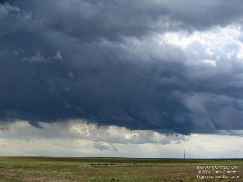
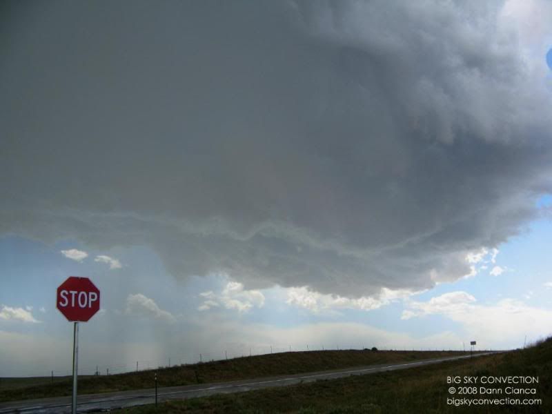
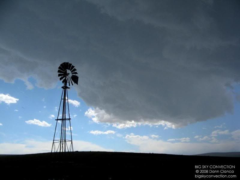
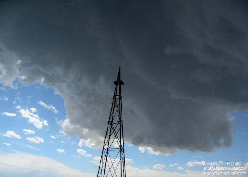
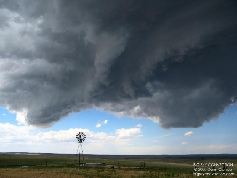
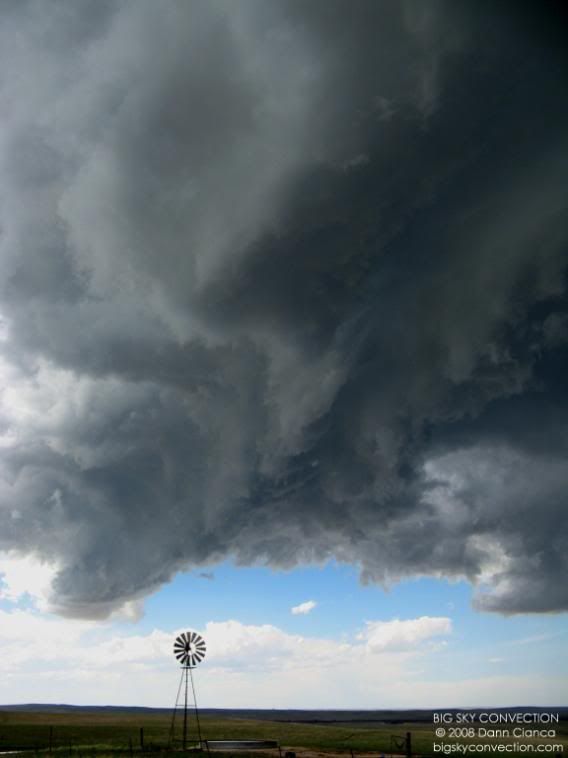
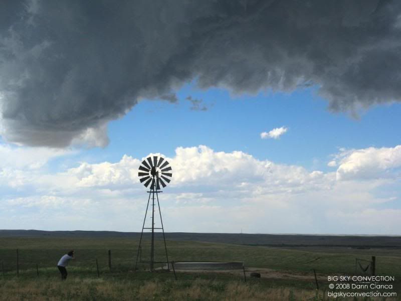
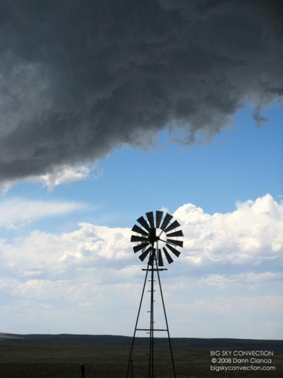
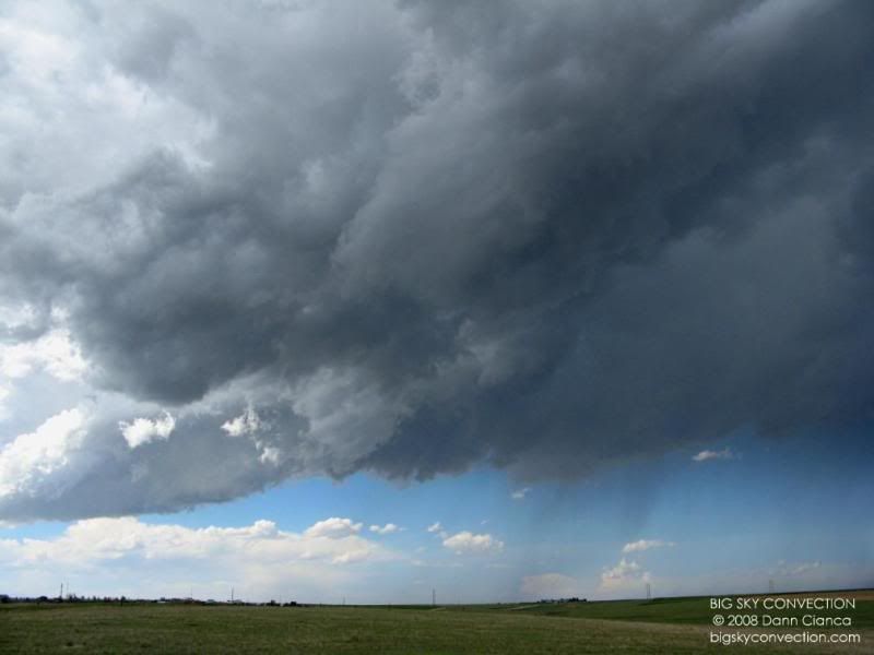
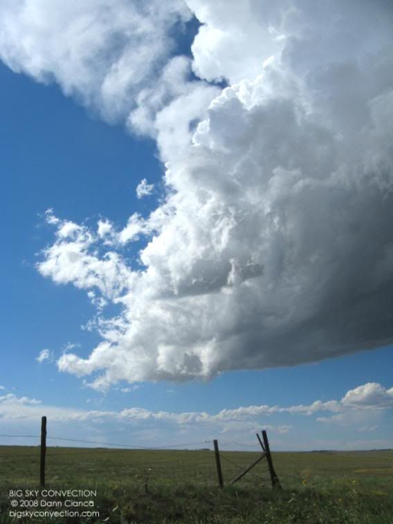
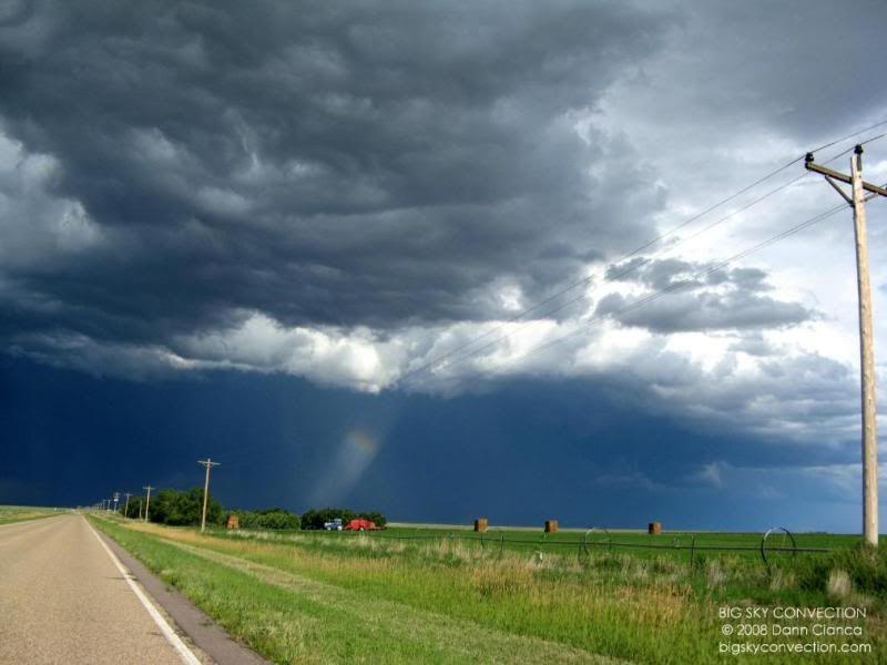
We
stopped about one mile south of Matheson. Michael wasn't all that aware of
the beautiful structure playing out as he was driving and could not see out the
right window. I was mesmerized by the structure. We had a good view
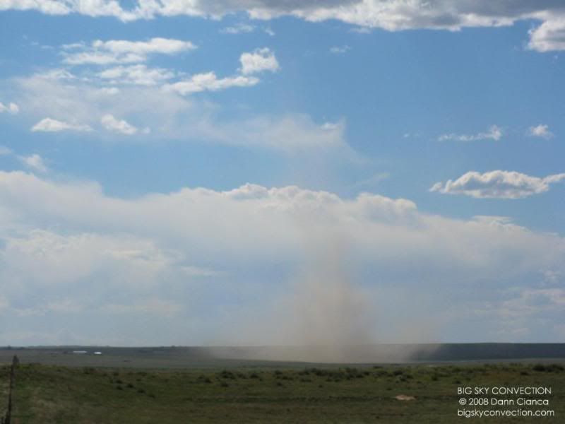
from the hill we had stopped on and when he got out, he was astounded! A
windmill was spinning very rapidly as the inflow winds howled into the
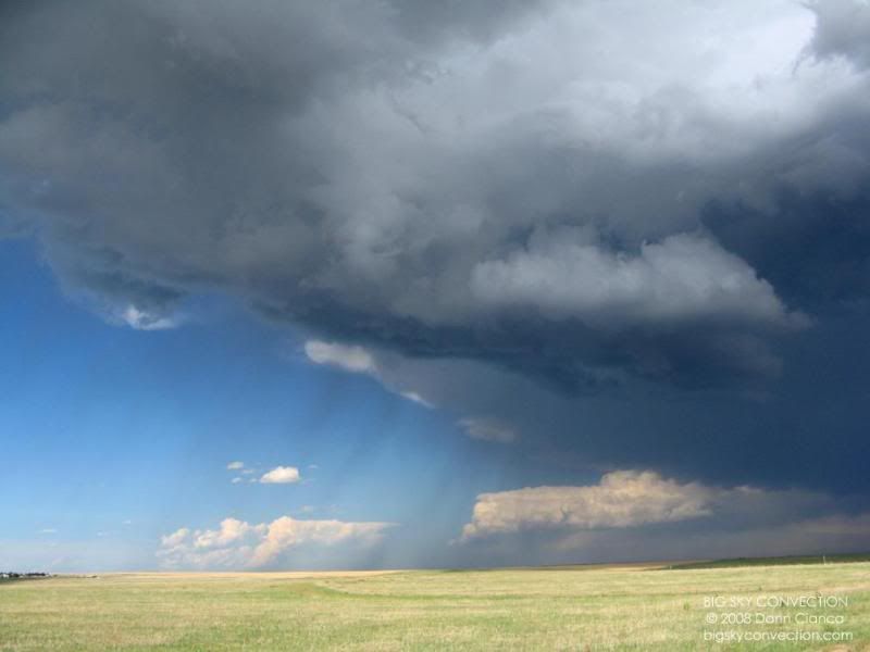
storm. We were just a few minutes ahead of the outflow of the main
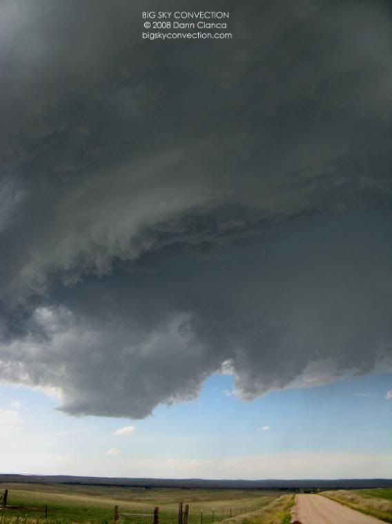
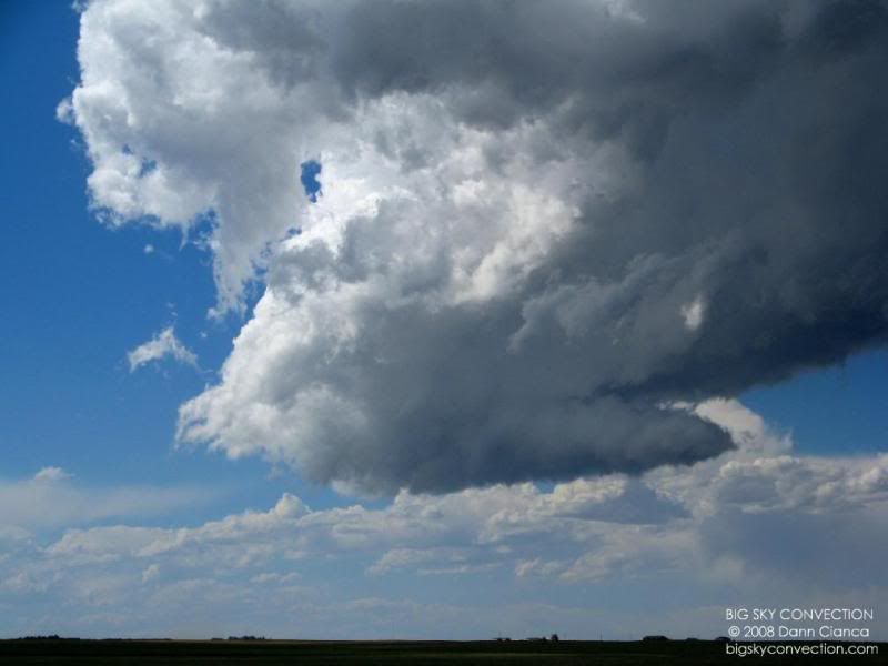
forward-flank downdraft at this point. This area is visible on the
pictures below with pronounced curving (almost shelving).
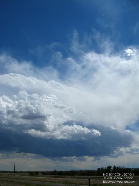
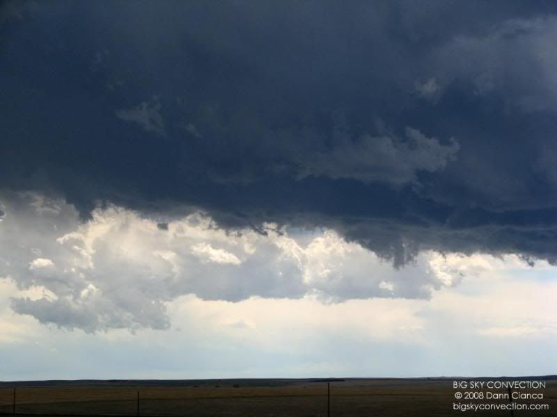
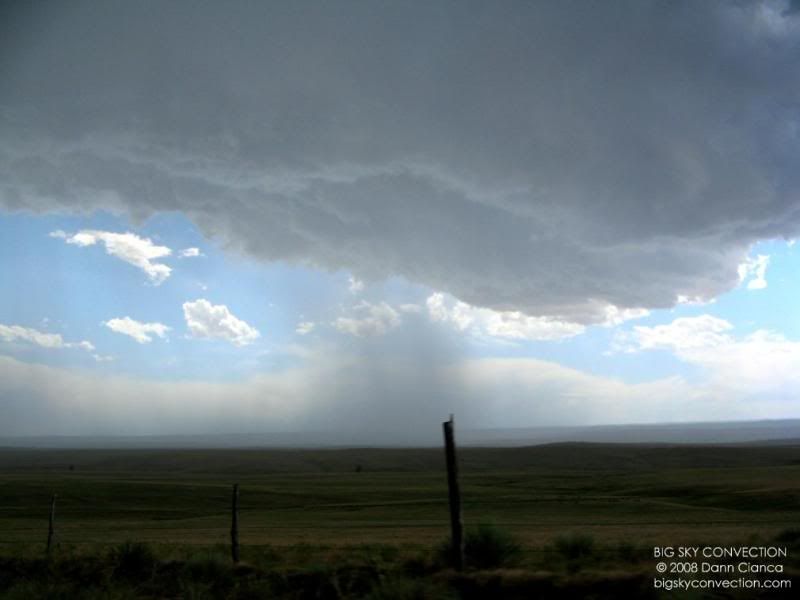
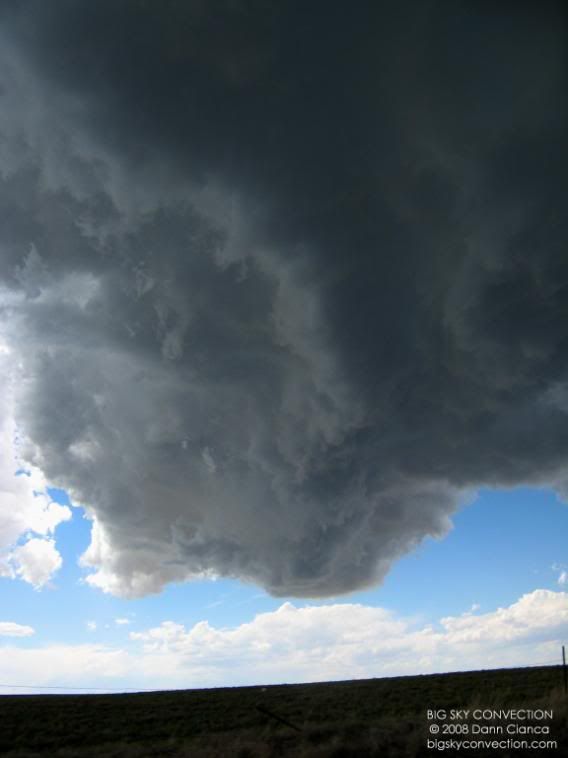
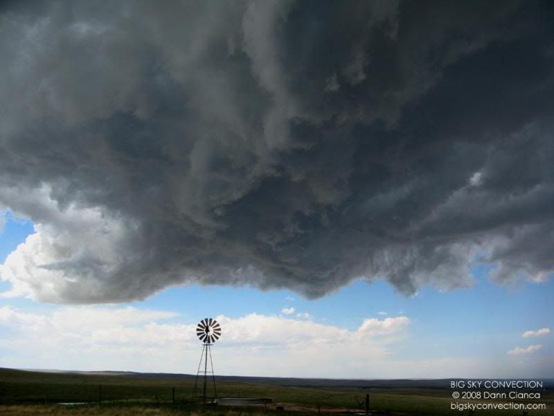
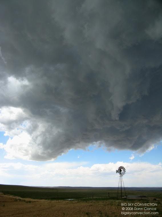
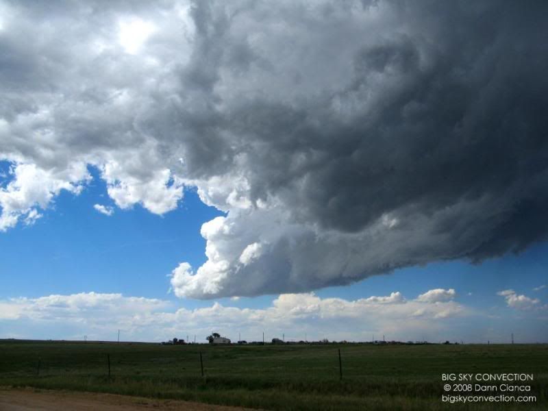
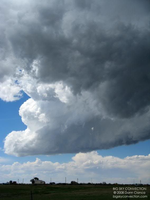
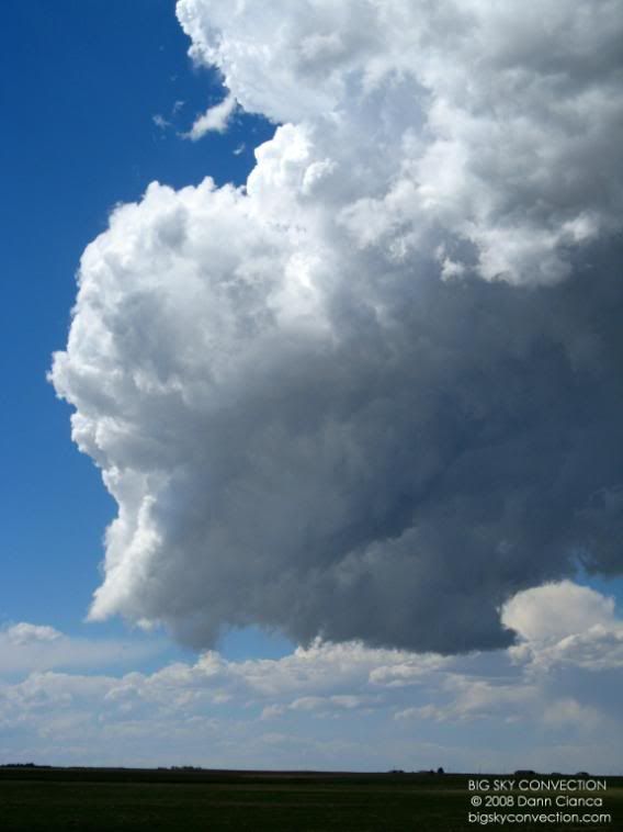
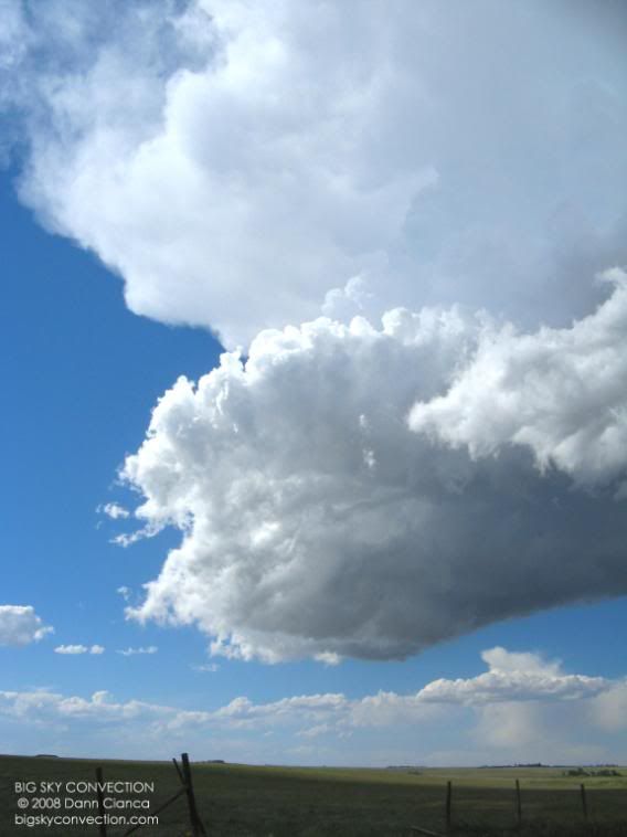
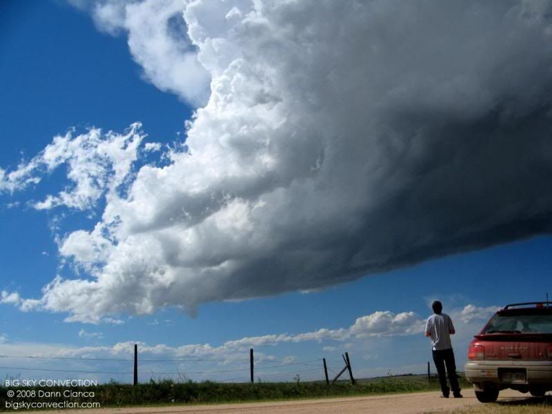
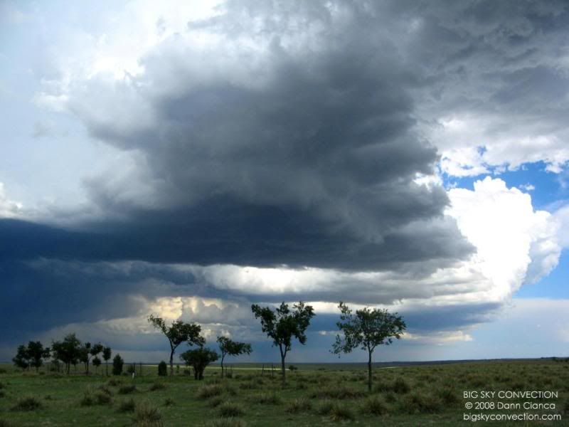
Another very interesting feature of this storm was an anterior updraft which had
signs of anti-cyclonic rotation. It was my belief at the time that
the storm was to split. In fact, later, a few flanking towers did
split off and move along the anterior-side forward flank downdraft
outflow. (And actually, with similar setup the next day, a storm
moved in almost identical fashion to this one and did split). The
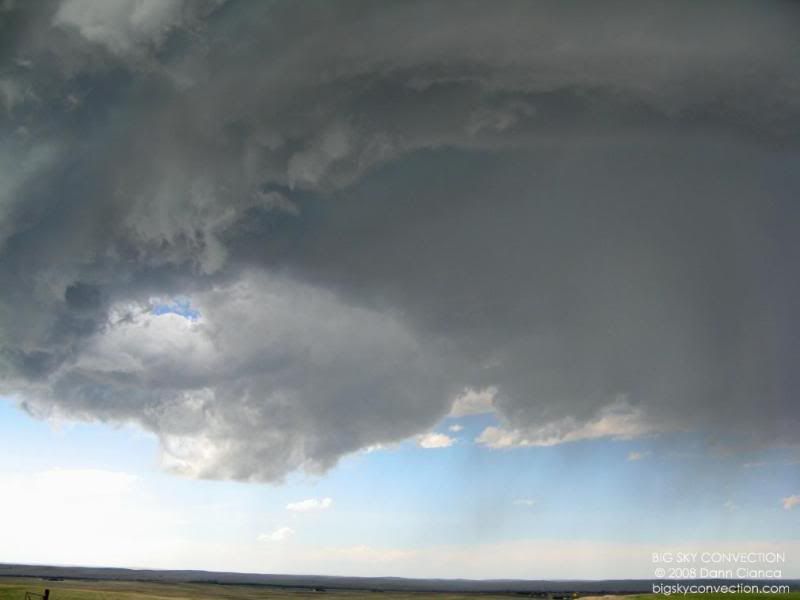
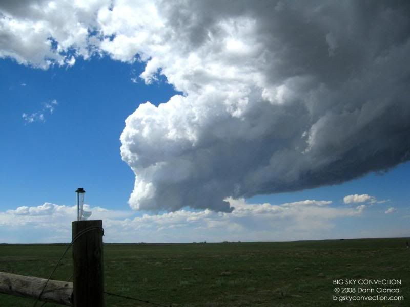
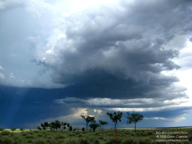
low-precipitation nature of this now supercellular storm gave us an amazing
skeletal view of the storm's
anatomy.
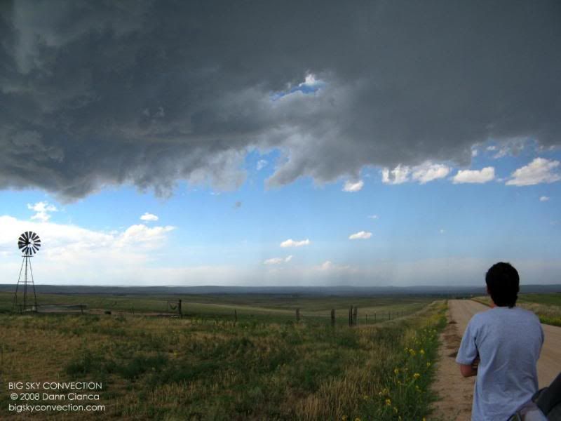
Michael and I hung around
until the outflow arrived, taking some video and pictures and just enjoying
being in the presence of this amazing storm.
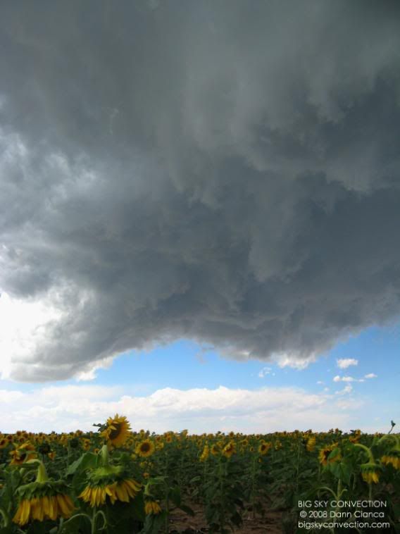
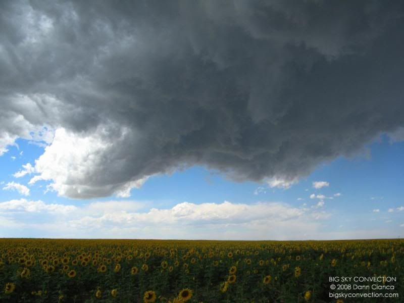
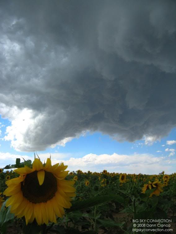
We had
only been back on the road for a minute or so before I saw a field of sunflowers
on the west side of the road. I thought it would be a good place to take a
few more pictures and Michael agreed.
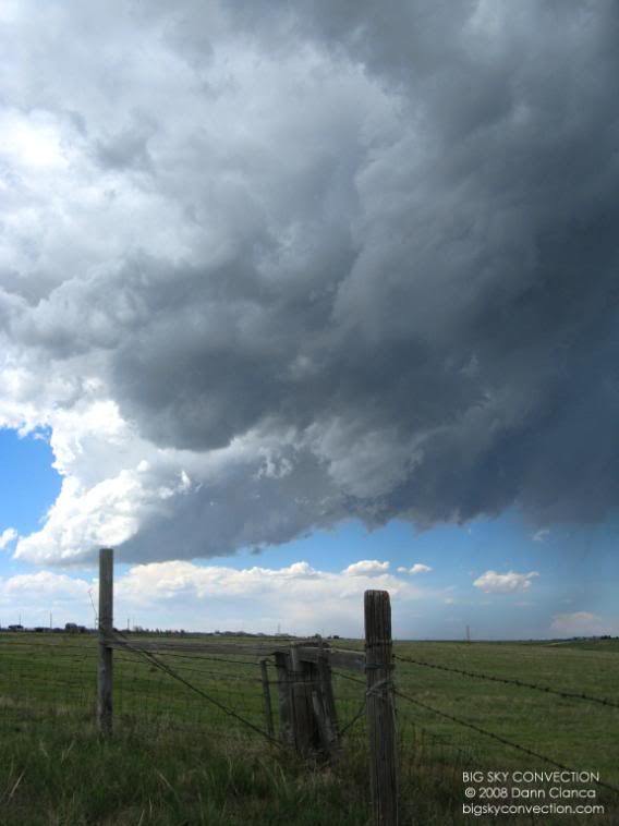
Back on
the road, we continued south to keep pace with the storm. We stopped again
at the junction of CR (County Road) 149 and CR 46. I got out and took a
few more photos and really focused on the motion of the
storm. Looking to the north and then northeast, there really
wasn't all that precipitation. The main core had shifted far to the east
with very turbulent-looking clouds bridging the core from the
updraft. It was a neat storm.
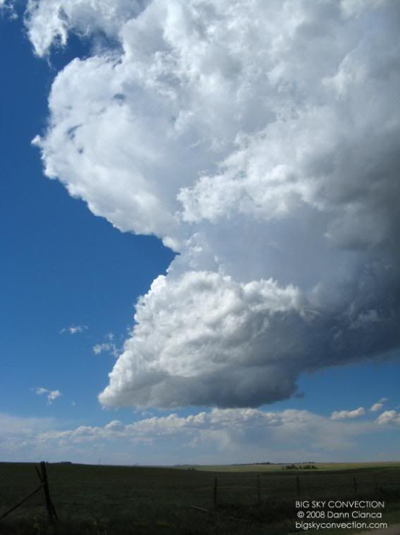
Looking off to the
north-northeast.
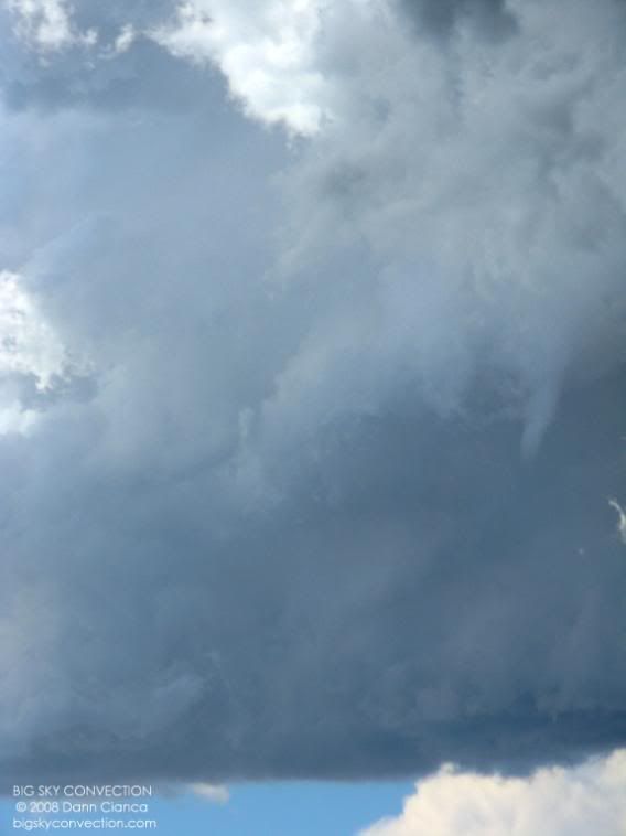
All of the sudden, we see an
elevated funnel cloud traveling west to east along the tilted updraft
tower.
No
longer willing to sit this far away, we traveled east on CR 46 to get in
better position on the updraft. The structure became more clear as we
approached. I'm not sure if it was rapidly strengthening or whether we
just had a better view. The updraft was rotating fairly rapidly at
this point. It was bizarre to see a well lit mesocyclone. I
called this feature the "jellyfish meso" as it was bulbous and seemed to have
tentacle-like appendages (mainly scud) twirling around
its base.
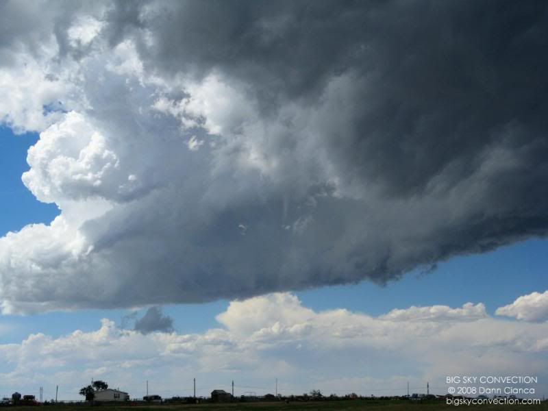
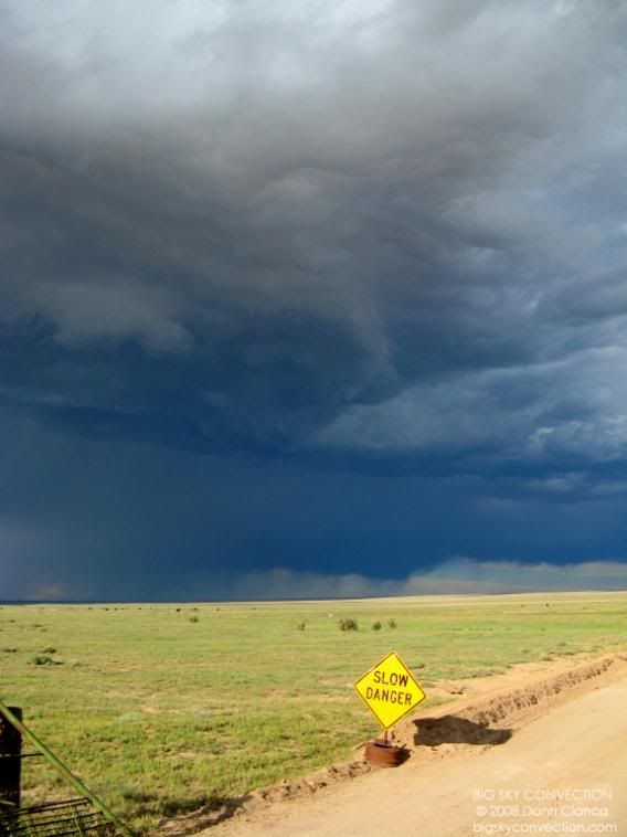
We
stopped for a good while at the intersection of CR 46 and CR 137. We
had position on the storm as it began to really interact with the stalled
outflow boundary which had basically become a moisture discontinuity or
dryline. I think it was this interaction that facilitated
tornadogenesis. From this point forward, dark horizontal rolls could
be seen in the updraft. The updraft must have picked up the vorticity
rolls from the boundary. This was an exceptional scene unfolding
before us!
Still, I kept
my eyes to the
beautiful scene to the northeast. The bridge from the updraft to the
main core was quite long and occasional showers would fall out of
it. The visibility to the north of the storm was fantastic. The
towers that had split off and rode the outflow to the north were beginning to
strengthen, so I was watching those as well.
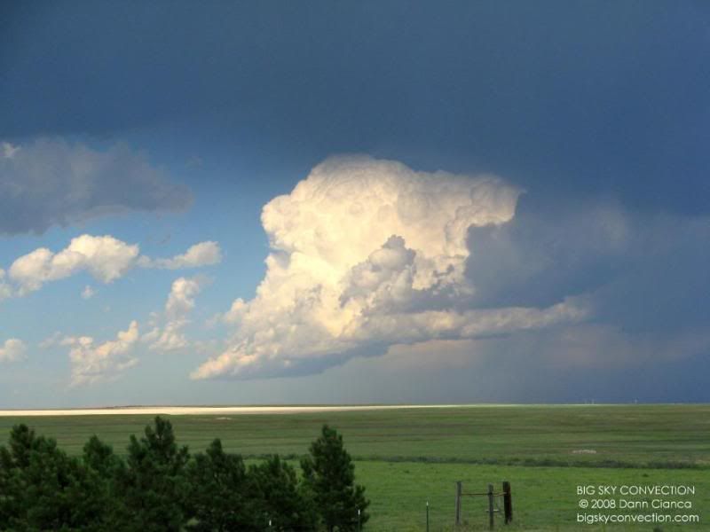
A wall cloud begins to form on this unique mesocyclone.
A strengthening tower to
the northeast.
Awesome mesocylone and wall
structure.
Looking due east to the main
core.
Horizontal vorticity tubes
picked up by the updraft.
Very interesting formation on
one of the northeast towers. It persisted for about five
minutes. Though I could see no obvious signs of rotation on the
tower, I'll leave the posibility open that it could have been
a non-supercell funnel as that tower was riding the outflow
boundary. If it weren't for the fact that our storm was spinning like
a top, I would have loved to have intercepted this storm and see it up
close. As it turned out, the feature disappeared shortly thereafter
and our attention returned to the storm at hand.
Again, horiztonal roll in the
updraft.
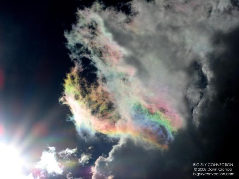
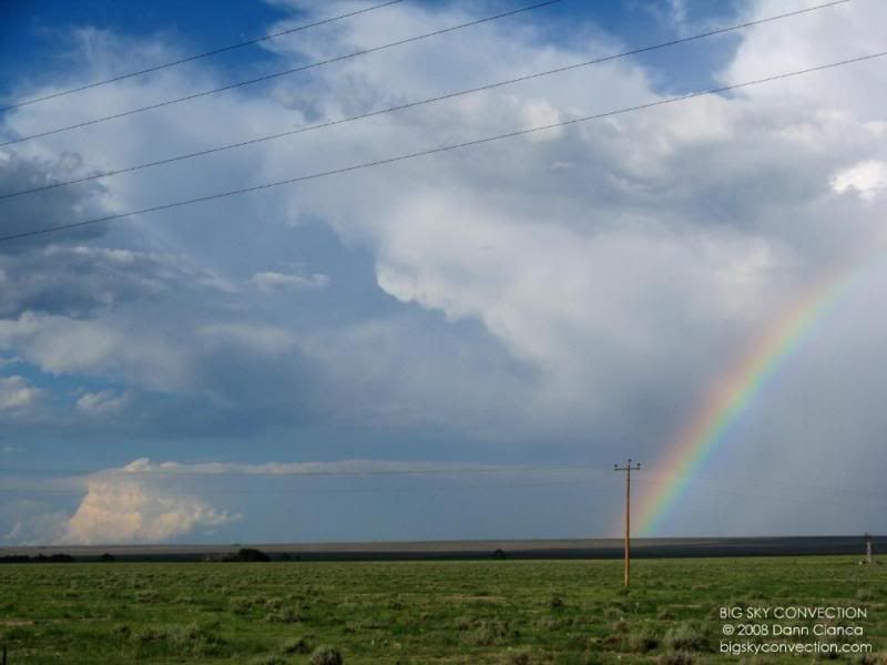
BELOW: Amazing iridesence
overhead.
We traveled north a mile or so to Harrisville Road and then west into El
Paso County. The storm had lowered quite a lot ... it was amazingly low
considering the dry conditions. Our eyes were focused hard on the updraft
and soon Michael saw something peeking out while I was taking video.
It took us only a moment to realize what exactly it was ... (this part is on the
video) ... and we saw a beautiful cone-shaped funnel veiled in updraft
scud.
My gaze
shifted to the west-southwest and my jaw dropped. There was a
large cloud of dust on the ground. It took a moment to process and I
pointed excitedly. Debris! Debris! I brought up the video
as Michael said "we have a touchdown!" I was literally shaking
(having never seen a tornado before). I did my best to capture the moment
via video (which is pretty bad video!) and then I saw the red battery light
flashing!
I
ran back to the car to
dig into my supply of double A's when my spotter training kicked in.
I dropped my camera and got on my phone. I dialed the Boulder NWS as I wasn't aware we
had passed into El Paso County. I'm not exactly sure what I said (my
memory seems to shot off on occasions like this), but I told them we had a
tornado in Elbert County and eventually was able to figure out what road we were
on (Harrisville) and a general location. This was enough to get the
warning out for Elbert County (a small sliver). El Paso County was warned
a few minutes later by Pueblo.
I quickly threw in some new batteries and continued taking video.
Michael wanted a closer intercept, so we hopped back in the car
and drove southbound and parallel to the tornado on Simla Highway.
Unfortunately, we didn't have a good east-west intercept option, so we settled
on a hill with a good view and watched the tornado dissipate.
Moments
later, we began getting calls and texts. "The storm you are on is
tornado-warned!" ... we knew. THAT was an awesome feeling. I
called Boulder back to let them know the tornado was gone and cleared up as
much information as possible at bout the location and
duration.
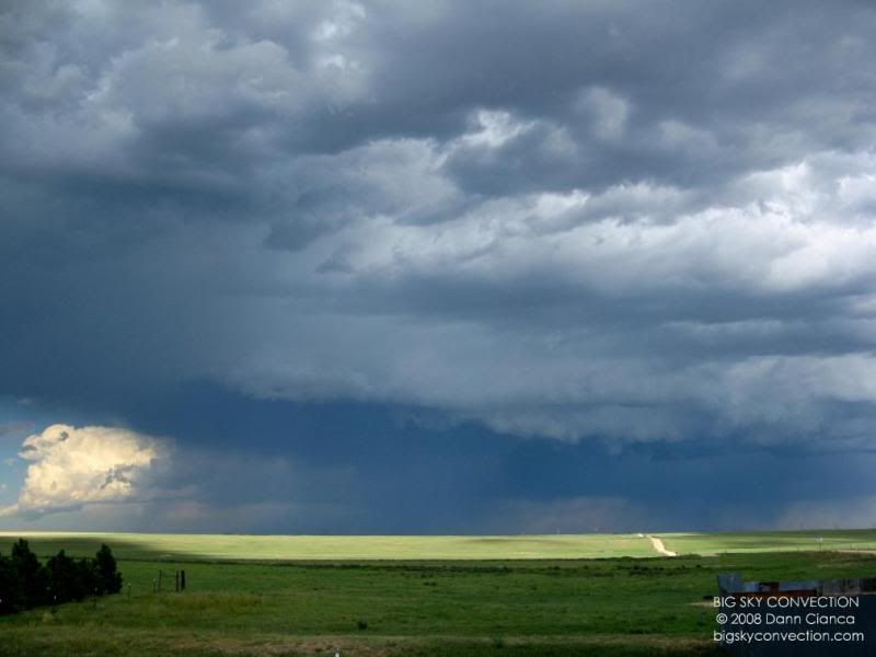
The storm's updraft
quickly lost strength and a consolidated along the "bridge" to the east.
It passed over us without a drop and we decided to follow it to the
east and then south. We were in contact with Tony too, who wanted some
shots for the 5 o'clock news at Channel 7. We found a place with good cell coverage and Michael uploaded some
photos. I took the time to take some more photos of the storm as it
moved off to the south east.
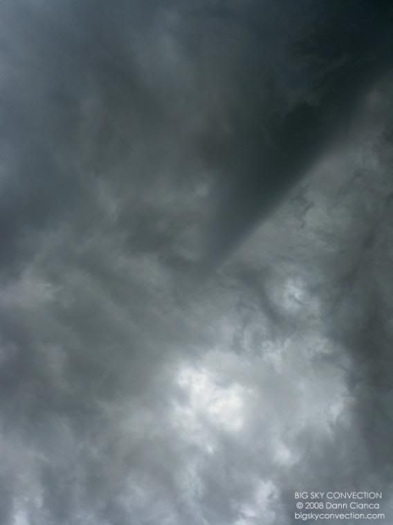
Amazing rear-flank downdraft
"hole" or "punch". (Subsiding air possibly related to the collapse of an
overshooting top).
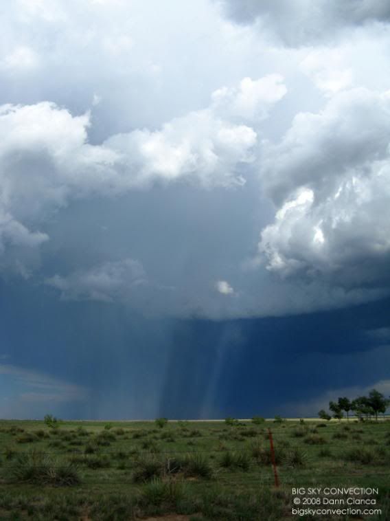
Anti-crepuscular rays made apparent by hail falling through the rear-flank downdraft.
We hung
out there for a while and I even spoke with a member of the Elbert County
Sherrif's Department who was out tracking the storm. Tony was texting us
updates on the storm's progress as well as other severe storms that had
developed to the south. We decided to try and intercept. The
following images were taken on Colorado 94 as we raced east to Colorado
71.
We cored a storm to the south of Punkin Center that had heavy rain and some small hail (maybe dime-sized at largest). Minesweeping for hail was certainly on the agenda as well. Coming out of the core we found out that the storms to the south were weaking, so we stopped to take recon at BB Road in Crowley County and decided to turn back.
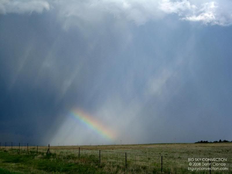
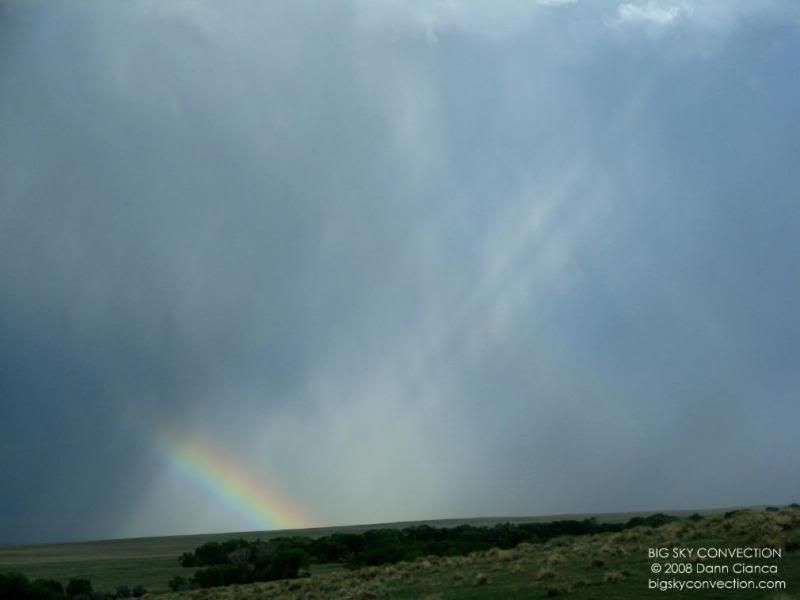
Another shot of a rainbow on the way
back north.
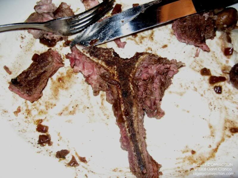
We took a nice leisurely ride back to Denver and met Tony and Ed Grubb at Outback near the park-and-ride for a big steak. That's what you do when you see a tornado, you eat a big freaking steak. I had the porterhouse cut. It was fantastic. (although the picture below looks really gross!!)
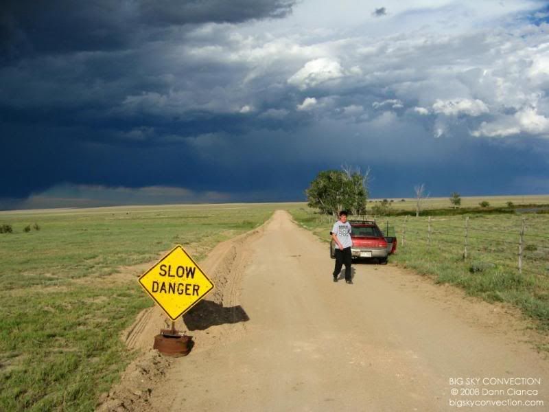
CHASE
STATISTICS
|
Miles Traveled: |
320 |
|
Rotating Storms: |
1 |
|
Funnel Clouds: |
at least 2 |
|
Cores punched: |
2 |
|
TORNADOES |
1 |
|
Largest hail encountered: |
0.50" |
|
Music of choice: |
Scary Kids Scaring Kids |
|
Snacks: |
True North Honey Wheat Peanut Crunches |
|
Restaurants: |
Outback Steakhouse (Denver) |
|
Memorable quotes: |
"That's my first tornado ... right there ...and I'm out of
batteries!" |
LINKS:
SPC CONVECTIVE OUTLOOKS FOR AUGUST 13TH
MESOSCALE DISCUSSION #2085
AUGUST 13th STORM REPORTS
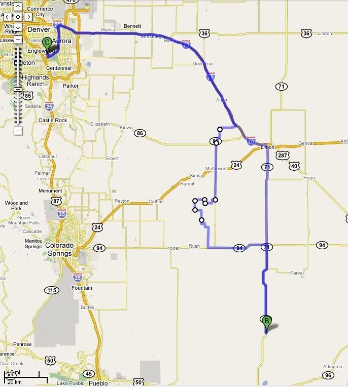
CHASE MAP:
This first video is the first cut I did of our chase. It's basically the raw footage with sound along with the 7NEWS footage.
This is the recut footage including time-lapse of the storm structure, the Good Morning America footage, and the sound is replaced wiht music.
TORNADO DAMAGE SURVEY INFORMATION WILL BE AVAILABLE SOON. PLEASE CHECK BACK.